Radai’s novel EM survey system provides information about the electrical conductivity of the subsurface. The applications of the EM system include geological mapping, mineral exploration, groundwater studies, geotechnical investigations, and environmental monitoring. The airborne system has the benefit of avoiding terrain obstacles and, thus, offers faster, safer, more cost-effective survey data.
Key concept
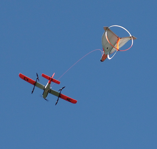
- Semi-airborne version uses fixed ground loop transmitter & airborne 3-component receiver towed by a VTOL drone
- Fully airborne version uses small (r<0.6m) transmitter loop attached to the towing drone
Receiver measures B-field (pT) - Noise level < 20 fT
3 frequencies (2.3, 4.6, 9.2 kHz)
1 Hz sampling - Flight speed ca. 20 m/s
- Flight endurance max. 60 min
- Depth of exploration 1-300 m
- Data post processing by 1D and 3D inversion