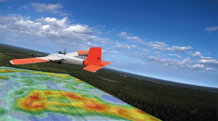
Radai operates high-performance magnetic survey system built on fixed-wing UAV’s. With flight times over two hours and simultaneous use of multiple drones, 1 000 line-km can be reached in a single day. Our VTOL drones are equiped with the Radai Mag System, a lightweight total-field magnetometer for drone operations. It provides high-resolution measurements for mineral exploration and geological mapping — delivering reliable results even in challenging terrain. Fast deployment and precise anomaly detection make it a powerful tool for modern geophysics.