In-house data processing software utilizing equivalent layer modelling (ELM)
BVLOS operations
Fluxgate magnetometer
3 orthogonal components
Noise level ±0.5 μT
Dynamic range ±100 μT
Sampling frequency up to 100 Hz
Base station
Proton precession magnetometer
Sampling frequency 1 Hz
Survey benefits
Fast and accurate survey method
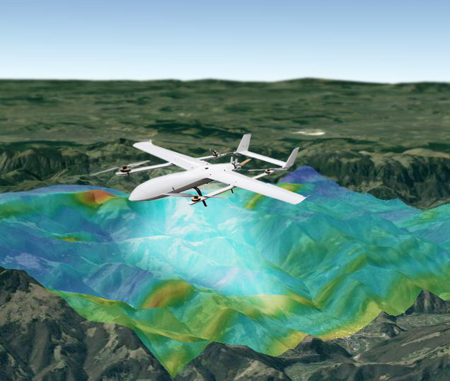
Drone follows terrain topography for better accuracy
Multiple UAVs perform survey simultaneously
Several hundreds of line-kilometres in a day
In addition to maps of magnetic field, Radai’s solution provides derivative results such as downward continutation, reduction to the pole, first and second vertical derivative, horizontal, tilt and total gradient. These derivative maps are highly useful in geological and structural mapping.