Skip to content
Home
Services
Drone-based magnetic total field surveys
Drone-based vector magnetic surveys
Drone-based electromagnetic survey system
Ground surveys
EM inversion services
Structural interpretation of magnetic data
3D inversion of magnetic data
Prospectivity mapping
Why Radai?
Success stories
News
Contact us
About Radai
Our team
Linkedin
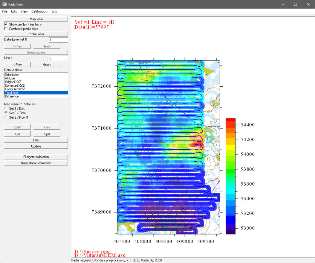
RadaiView – magnetic UAV data viewer software
RadaiView – magnetic UAV data viewer software
Basic functions
Read raw data (CSV, TXT, BIN)
Altitude from barometric pressure and DEM (if no RTK GPS)
Map coordinates (UTM or ETRS-TM35FIN)
Fluxgate sensor calibration
Orientation correction
Data visualization as maps and profiles
Base station correction
Data cutting, joining and filtering
Save data (UAV)
Limitations (from RadaiPros)
No fluxgate calibration GUI
No tie-line levelling
No equivalent layer modelling (ELM)