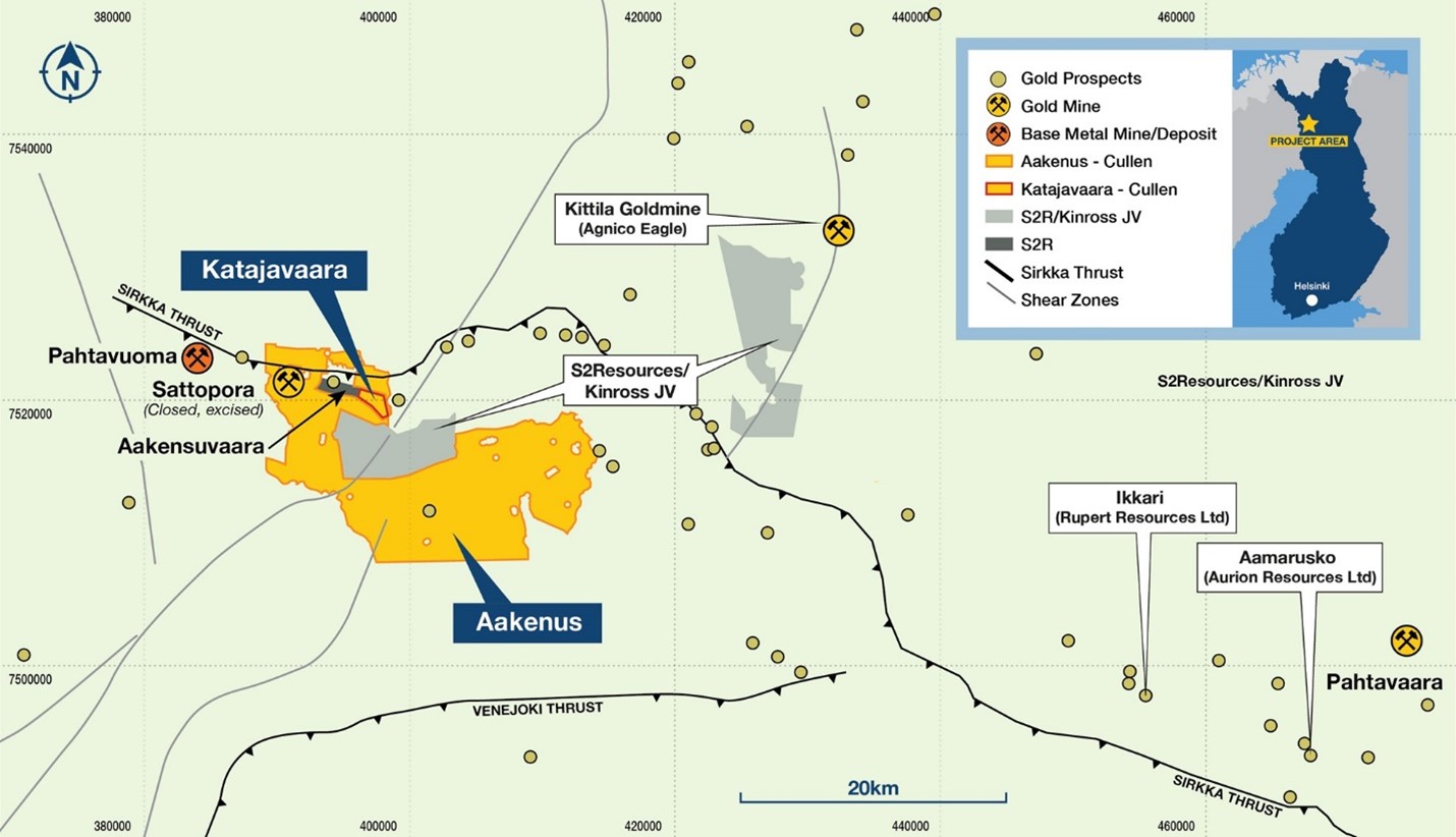
Work is never boring for an employee of Radai. Even though everyday tasks include a fair number of routine operations, the work environment is always different. As Radai’s drone flying crews travel across Scandinavia for various projects, each survey happens in a different place and has its natural characteristics and technical specifications. Therefore, every project is unique and worth remembering. Some projects are more memorable than others. Usually, the challenging ones are the ones that make the strongest impression. So was the situation of the mineral exploration survey which was done in March 2022 in Central Lapland, Aakenus area, on behalf of Capella Minerals.
The project was noteworthy for several reasons: its size of 4 000 line-km was among the biggest ones handled so far by Radai’s teams. It was also the first time when Radai’s drones flew in such proximity to an airport.
People that are slightly familiar with professional drone operations are aware that flying drones near an airport is an adventure in itself. The process starts well before the actual flying takes place and requires special permits from various decision-makers, long discussions about the delimitation of flying areas, and close contact with aeronautic authorities. Flying operations had to follow a strict plan and a schedule that was agreed upon well in advance but, at the same time, the flying crew had the obligation to stop activities at any time at the request of aeronautic authorities. The completion of the project requires strict adherence to the plan and the ability to adjust operations at a short notice.
Because of the large size of the survey area, it was decided that two crews were needed to fly simultaneously. That further complicated the already challenging characteristics of the project, and implied very fine-tuning and close coordination between units. The pilots were continuously in contact with each other and with the Kitillä Airport Control Tower. In several instances, the drones had to be called back to base in midair at the request of Air Control authorities. Arctic spring weather kept the pilots on their toes and, at some point, the activities had to be stopped and were continued 2 weeks later.

The scope of the project was to get a better understanding of the geology of the till-covered gold-copper mineralized systems with the help of a high-resolution drone magnetic survey. The assignment was completed in March 2022 by 2 teams working simultaneously during 2 campaigns. The 4000 line-km were flown using four Puffin VTOL drones which were equipped with Radai’s multipurpose RMP data loggers. The magnetic field was measured by a digital 3-component fluxgate magnetometer that is located in the tail boom of the drone. In addition to the three orthogonal components of the magnetic field, the datalogger recorded temperature and barometric pressure, which is used to determine barometric flight altitude. The GNSS (GPS+Glonass) time (UT) and position (latitude, longitude, and altitude) were also recorded. During the flight, the horizontal accuracy of the GNSS positioning is about ±0.5 m and the vertical accuracy is about ±1 m.

After take-off, the flight was controlled by an autopilot that guides the drone through a predefined set of waypoints. The flight path followed terrain topography defined by the digital elevation model (DEM) provided by the National Land Survey of Finland. The flight performance was controlled by a PC software via telemetry (radio) link and/or a wireless mobile 3G/4G link in real-time. A separate GSM-based tracker device allowed for locating the UAV in case of a lost telemetry signal or a drone crash. This is the “routine”, technical description of the project – which requires a high level of precision and workmanship and shouldn’t be dismissed as mundane.
Despite its challenging nature, the project was completed in a record number of 7 flying days and without any technical malfunctions. Communication and collaboration with Kittila Airport authorities were very good and demonstrated that when excellent professionals are involved, drones can fly alongside standard airplanes. The data gathered during the project was regarded by Capella Minerals as high quality.
Eric Roth, Capella Minerals President, CEO & Director, commented: “We are very pleased to have selected Radai as the contractor to complete the drone magnetic survey at our Katajavaara-Aakenus project. Radai’s crews worked to the absolute highest levels of professionalism and were able to complete the survey in an expedited fashion. The information obtained from this survey will be invaluable in enabling Capella obtain a better understanding of the geology and mineral potential of the Katajavaara-Aakenus area.”
Capella Minerals Ltd is a Canadian gold and copper exploration and development company with a well-seasoned portfolio of high-grade gold projects located in Canada, Norway, Sweden, and Finland. The company is well known for its profitable projects and has a proven track record of success in finding, growing, and advancing mineral discoveries.